Computational Methods
Cartography:
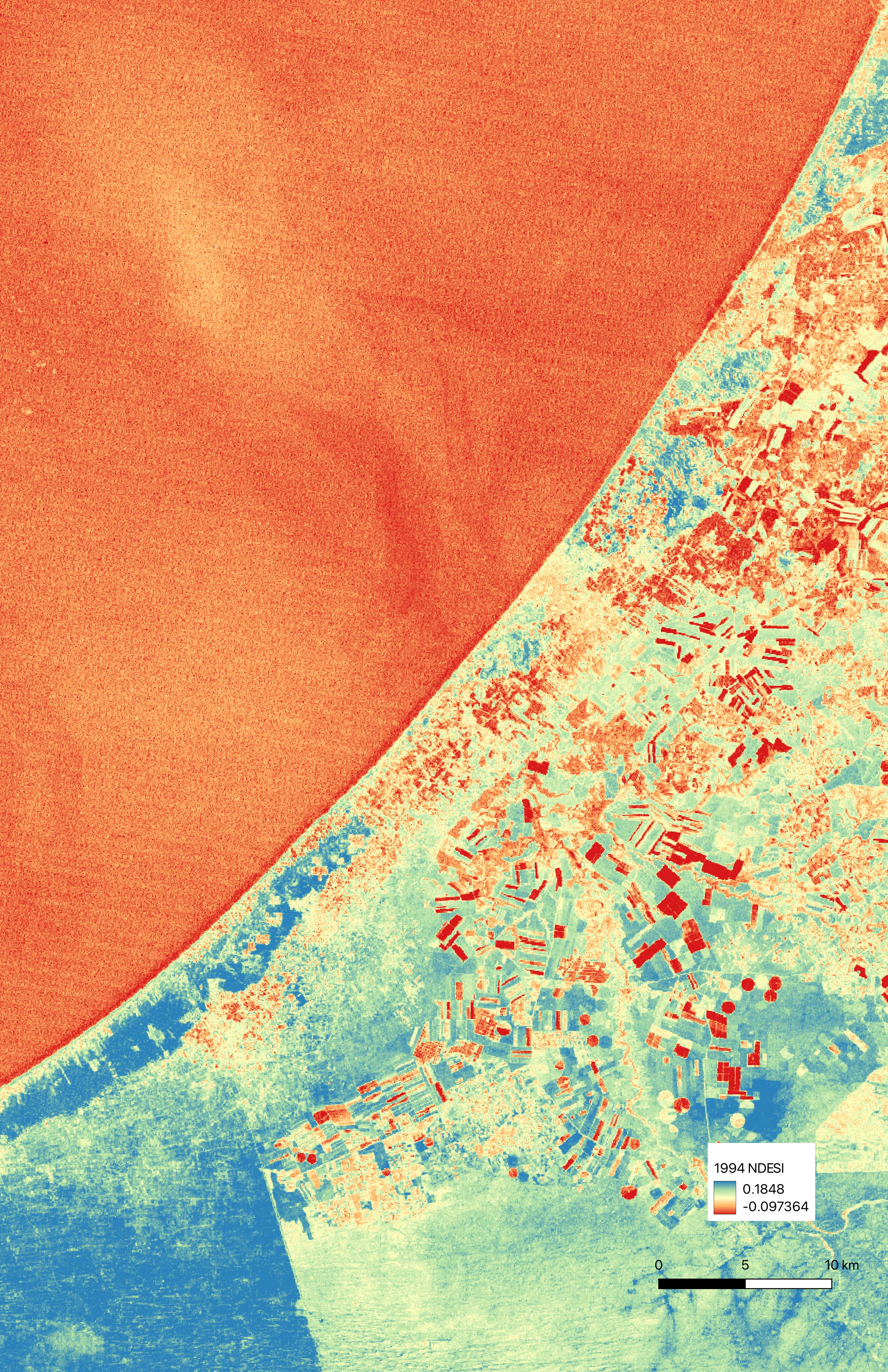
Explored:
- Georeferencing
- Layering
- Tracing
- True color image analysis
- NDVI analysis
- NDESI analysis
- Storytelling through an atlas
Yet to explore:
- Locating imagery in 3D space with QGIS and Blender
- Using satellite data for soil moisture analysis or InSAR data for measuring urban destruction over time
These methods allow me to investigate and narrate change over time, and to an extent to identify what’s on the ground from afar, such as the evolution of the sand dunes I researched this semester.
Coding / web development:
- Creating a tagged source database
This method allows me to create a visual index and overlapping categorization system, helping me to see what themes appear across sources. Moving forward I’d love to make this database understandable and useful for other people as a resource.
My other (not necessarily computational) methods include writing, informed, speculative drawing (such as mapping oral testimonies or creating cross-sections of land based on soil sampling tests), and collapsing and juxtaposing scale between the micro and macro (such as in this video piece). I think that all of these methods help me access the affective spaces of the content I am working with, which I think is really important as I work with such devastating topics.